Lidar Survey
LiDAR (Light Detection and Ranging) uses eye-safe laser beams to create a 3D representation of the surveyed environment. We know just precisely how to analyze and aesthetically present the data...
Experience Precision with LiDAR Surveys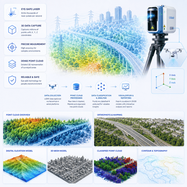
LiDAR (Light Detection and Ranging) uses eye-safe laser beams to create a 3D representation of the surveyed environment. We know just precisely how to analyze and aesthetically present the data...
Experience Precision with LiDAR Surveys
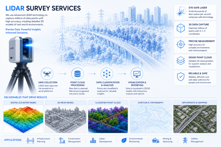
Our LiDAR Survey services utilize advanced Light Detection and Ranging technology, employing eye-safe laser beams to generate highly accurate 3D representations of any surveyed environment. We possess the specialized expertise to precisely analyze and aesthetically present this complex data, ensuring our clients receive clear, actionable insights and visualizations critical for their projects.
Why this service stands out
Obtain highly precise and detailed 3D spatial data unmatched by other methods.
Penetrates vegetation to reveal true ground topography for informed analysis.
Collect vast amounts of elevation data rapidly, even in challenging environments.
Survey hazardous or inaccessible areas remotely, minimizing risks to personnel.
Generate stunningly realistic 3D models for better project understanding.
Ideal for urban planning, forestry, engineering, flood modeling, and more.
What makes this service stand out
Creating extremely accurate three-dimensional models of terrain, structures, and environments with fine detail.
LiDAR's ability to penetrate dense foliage reveals ground features hidden by vegetation, crucial for accurate mapping.
Generating precise DEMs, Digital Surface Models (DSMs), and Digital Terrain Models (DTMs) for various applications.
Detailed mapping of utility lines, buildings, roads, and other assets for management, planning, and maintenance.
Accurate calculation of earthwork volumes, stockpile sizes, and object dimensions for construction and mining.
Comparing LiDAR data from different time periods to detect and quantify subtle or significant environmental and structural changes.
How we deliver results
Defining the survey area, desired data resolution, and specific deliverables for your LiDAR project.
Performing aerial or terrestrial LiDAR scans to collect millions of precise elevation points.
Processing raw LiDAR point clouds to remove noise, classify features, and generate various models.
Performing spatial analysis and delivering detailed 3D models, DEMs, reports, and visualizations.